Wednesday, August 29, 2012

War of 1812 Road Trip, Day 3 . . . Mississinewa and A Few Forts

This is the day we started rockin.'  We covered a lot of ground and said goodbye to Indiana and hello to Ohio.  These remaining posts related to our tour of War of 1812 sites should be action packed!

Our first destination of the third day was the 
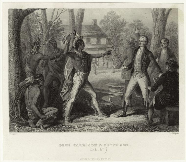
Mississinewa Battlefield located just north of Marion, In.  These early engagements (December 17-18, 1812) were basically a continuation of what Harrison had done at Tippecanoe.  Harrison ordered Lieutenant Colonel John B. Campbell to move against the Miami villages located in this area.    

Campbell's force of around 600 troops attacked a couple of surprised villages razing one to the ground, killing several Indian warriors and capturing many others, including many women and children.  However, the next morning, on December 18, the Miami and Delaware forces counter-attacked, and a short but fierce engagement ensued.  The monument above is inscribed . . . "Here on December 17-18, 1812, approximately 48 members of the Miami and Delaware Indian Nations gave their lives in defense of their homes, families and lands."

The monument in the foreground states . . . "Here on December 17-18, 1812, twelve members of Lt. Col. John B. Campbell's command gave their lives in the campaign against the Indian villages of the Mississinewa in the War of 1812."  I guess it is a matter of perspective.

Gravestone markers for the 12 soldiers under Campbell . . . six of them were from Kentucky.  Leaving the battlefield, the survivors then had to endure a long retreat coupled with extreme cold . . . about half of the men suffered from frostbite.    

Harrison claimed the campaign as a success, but we are talking about the consummate self-promoter.  Three villages were destroyed, but Campbell was forced to withdraw.  Today, the Battle of Mississinewa is the largest War of 1812 living history event in the United States.  Hopefully, Dudeboy and I can entice Screamin' Killer Davis to join us on a road-trip in October to witness the big doings.
The Battle of Eel River . . . located near Columbia City, In.  The marker reads:
After General William Henry Harrison relieved Fort Wayne, he ordered Colonel James Simrall in September 1812 to prevent further Miami Indian attacks in the area.  The Miamis fled as troops destroyed villages, crops, and supplies along Eel River; Miamis then stood to fight a losing battle on this site.

Above is a recreation of Old Fort Wayne (within a quarter a mile of the actual location) representing the years 1815 to 1816.  The original fort (in yet another location) was established by General "Mad" Anthony Wayne in 1794 before the Battle of Fallen Timbers.

In the War of 1812, Native Americans, bolstered by the fall of Detroit, Fort Dearborn, and Fort Mackinac, lay siege to Fort Wayne.  The fort, which was in a somewhat state of disrepair, was commanded by Captain John Rhea who was apparently inebriated for much of the time.

Starting on the morning of September 5, 1812 the Native Americans began a series of attacks.  News of relief troops emboldened another attack on September 11, but was called off as Harrison's reinforcements began to arrive.

The actions at Ft. Wayne prompted Harrison to take the initiative at places like Mississinewa and Eel River.  In September there will be a living history event to celebrate the 200th anniversary of the siege.

Located within yards of Ft. Defiance, Harrison ordered the construction of the more substantial Fort Winchester in October of 1812.  While on the frontline of defense, the fort was never seriously threatened.  However, it was used extensively as a staging area, and Col. Richard M. Johnson trained his Kentucky Mounted Regiment here.

This sign states: "Fort Winchester . . . Built by Gen. Wm. Harrison in Oct., 1812 and named for General Winchester.  For a time it was the only defensive work against the British and Indians in North-western Ohio."

Fort Defiance in Defiance, Ohio.

While rightly associated with General "Mad" Anthony Wayne and the Battle of Fallen Timbers, the deteriorated Fort Defiance was used as a staging area during the War of 1812.   

By the way, the name Fort Defiance was derived from the declaration of the commander of some Kentucky militiamen under Wayne.  He stated that "I defy the English, Indians, and all the devils of hell to take it."  But then again, I have also seen that quote attributed to Wayne.

Monument erected by the Ohio Daughters of the American Revolution.  It reads:
Fort Defiance was erected upon this site by General Anthony Wayne August 9-17, 1794 and thus "the grand emporium of the hostile Indians of the west was gained without loss of blood."  From this point General Wayne advanced against the Indians and signally defeated them in the Battle of Fallen Timbers, August 20, 1794.  At this strategic center, in October, 1792, convened the largest Indian council ever held on the American continent.  Fort Defiance was an important military post in the War of 1812. 


Gravestone and historical marker for Spemica Lawba . . . Captain Logan.  The text reads:
In September 1786, Captain Benjamin Logan of Kentucky captured a young Indian boy during a raid across the Ohio River on the Machachac tribe towns of the Shawnee nation. Upon returning to Kentucky, Captain Logan made the 14 year old boy part of his family until he was forced by treaty to return him to his native people. From the period of residence in Kentucky to the time of his death, Johnny Logan, as he was named, was a friend of the United States. Following the declaration of war against England in 1812, he joined the American service. He was employed by the Indian Agent John Johnston at Piqua to help evacuate Ohio women and children living near Fort Wayne. The siege of that fort was later lifted by the combined force of Kentucky and Ohio troops under the command of General William Henry Harrison.  In November 1812, General Harrison directed Logan to take a small party ahead of General James Winchester's left wing to scout the area near the Rapids of the Maumee River. Encountering a larger enemy force, Logan's party retreated and was accused of disloyalty by General Price, second in command to Winchester. Indignant, Logan left with Captain Johnny and Bright Horn to prove his innocence. They were, however, captured near Turkeyfoot Creek by British sympathizer Potawatamie Chief Winnemac and Matthew Elliot, son of a British Indian Agent. During their escape, four of the enemy, including Winnemac and Elliot were killed. Bright Horn and Logan were wounded, but Logan's wound was severe. He died on November 25, 1812. Army officers carried Logan's body six miles to Fort Defiance where he was buried with full military honors, the only Indian to receive that recognition in Ohio. 


Monday, August 27, 2012

150th Battle of Richmond, Ky.

Just a few pictures from the reenactment at Richmond . . .

 Dudeboy cutting loose doing the Virginia Reel.

 He is certainly braver than his father!

We'll return to the War of 1812 trip in a day or two.  I am sure you are dying of anticipation.

Thursday, August 23, 2012

War of 1812 Road Trip, Day 2 . . . Tippecanoe and Prophet Too

This recreation of Prophet's Town is located at the Woodland Indian Settlement in Prophetstown State Park.  The original settlement was founded in 1808 by Tecumseh and his brother Tenskwatawa (The Prophet).

William Henry Harrison, feeling a bit antsy about all of the "increased Native American presence at Prophetstown," moved his troops within half a mile of the settlement.

The Prophet, feeling a bit antsy about having all of those troops so near, (Tecumseh was away) decided for a preemptive strike into Harrison's camp on November 7, 1811.

All of the above resulted in the Battle of Tippecanoe; afterwards Harrison's troops razed Prophetstown to the ground.

Dudeboy feeling a bit of family angst . . . his gr-gr-gr-gr-gr grandfather Benjamin Shacklett was part of Major-General Samuel Hopkins second destruction of Prophet's Town (it was being rebuilt at the time) in November of 1812.  They apparently encountered some fairly ghastly sights from the year before.  Benjamin Shacklett is mentioned specifically by Major-General Samuel Hopkins in a letter to Kentucky Governor Isaac Shelby (November 26, 1812 near Fort Harrison) ". . . my thanks are due, as also to colonels Miller and Wilcox, and to major Hughes and Shacklet(t)."   


The battlefield mainly encompasses the encampment of Harrison's troops.  A wrought-iron fence marks the position of the the lines and encampment.

The fence next to Dudeboy is the approximate location of most of the Kentucky riflemen.

One of a few monuments marking a deathsite of a particular officer . . . this one is for Captain William C. Baen of the Fourth Regiment.

The Battle of Tippecanoe was not the decisive victory that Harrison claimed.  The natives did leave the battlefield, but they suffered fewer casualties.  Of course, one major result of the battle was the public outcry, particularly from warhawks like Kentucky's Henry Clay, which in turn fueled the oncoming War of 1812.  
    
Variously called the Battle of Wildcat Creek, The Second Battle of Tippecanoe, or Spur's Defeat* this engagement was part of the Major-General Samuel Hopkins expedition to sack the settlements at Tippecanoe, Wabash and Eel River.  I have found no evidence that our Benjamin Shacklett participated in this fiasco (he was busy laying waste to Prophet's Town).  A group of about 60 scouts were ambushed . . . as one man reported, "We retreated in every kind of disorder the best way we could."  Hence the name Spur's Defeat, which refers to the spurs the soldiers put to their horses.
 
*The old sign shown in this link no longer exists.  We went to the location and got confirmation from a local . . . who looked at me like I was crazy for asking about it.

Monday, August 20, 2012

War of 1812 Road Trip . . . Day 1

Kind readers, the Fife clan has just returned from the first leg of our Tour of the War of 1812.  Hopefully, over the next couple of years we will flesh out this trip with excursions to Canada and finally ending in New Orleans.  However, first off, we have much to relate about this trip.  There will be multiple blog entries . . . each of the 8 days of the trip that pertain to the War of 1812 (be it physical sites or peripheral oddments), and then there will be some entries that relate some of the other non-1812 sites we visited.  This was an action packed trip.  We learned much, and hopefully you will as well.  

Grouseland . . . the home of William Henry Harrison in Vincennes, In.  This Federal-style house was built while Harrison served as the Indiana Territorial Governor.  This area encompassed what today makes up Indiana, Illinois, Wisconsin, and parts of Minnesota and Michigan.  Once Harrison became commander of the Army of the northwest during the War of 1812, he did not return to live there.  The home did stay in the family for a bit before serving as a private residence, hotel, and finally as a barn.  In the upper part of the back end of the house are obvious cracks still visible from the New Madrid Earthquake of 1811-1812.  As with so many fancy-pants homes, photography was not allowed inside.

Harrison used Grouseland as a place to have meet and greets with the Native Americans from whom he swindled a good bit of land.  However, one man would have none of it.  The great Shawnee Chief Tecumseh visited Harrison a couple of times, but refused to enter the house.  The actual site they met is in the background near the buildings in what is now a gravel parking lot . . . a dramatic setting for their memorable confrontation.

Attack at the Narrows (September 15, 1812) . . . historical marker located in present day Fairbanks, In.  Actual location of battle site is located nearby in an area of ravines called "the narrows."

Siege of Fort Harrison (September 4 - September 15, 1812) . . . site of the first significant land battle won by US forces.  The smaller Battle of Monguagon in Michigan took place on August 9, 1812.  We will revisit that site in a future entry.  The actual site of Fort Harrison is located on the property of a country club.  

Armiesburg . . . historical marker in Armiesburg, In.  Harrison and Hopkins had encampments here at one point or another . . . hence the name.  Surely this is evidence of just how thorough we are!

Saturday, August 11, 2012

House Sitting Day 6 . . . William Whitley

Whew . . . our last day of house sitting.  The William Whitley House State Historic Site . . . the oldest brick house in Kentucky.  The estate was known as Sportman's Hill because of the racetrack William Whitley built in 1788.

Whitley was an Indian fighter and hater of Tories.  In fact, Whitley hated the British so much that he ran the races on his track counterclockwise, which became the standard in the America.

The house was designed with Indian raids in mind.  There were a couple of secret hiding places, and most of the windows are made with what amounts to as gun slits.

Cantankerous to the end, Whitley, at age 64, was killed at the Battle of the Thames during the War of 1812.  There is some speculation that it was Whitley, and not Johnson, who killed Tecumseh at that battle.  It is said that Whitley exclaimed that "the death he craved to die was in his country's defense."

Friday, August 10, 2012

House Sitting Day 5 . . . Camp Nelson

While in the Bluegrass area we were lucky enough to participate in an archaeological dig at Camp Nelson, located just south of Nicholasville.  Camp Nelson was a Union supply depot, refugee camp, and a major recruiting and training center for African American troops . . . it was the third largest in the nation.

The archaeological dig we participated in was located in the area of a sutler store.  Mostly we found nails, bits of glass, wire, and such.

A person next to Dudeboy found a mule-shoe.  I think a button was also found.

However, it seems the most excitement was generated by this sardine tin.


This is the only original building to survive from the days of Camp Nelson.  The "White House" as it was known served as the officers' quarters.

Monument for Graveyard No. 1.

Recreation of Fort Putnam, based on period maps and archaeological studies, which is part of the defense network surrounding Camp Nelson.