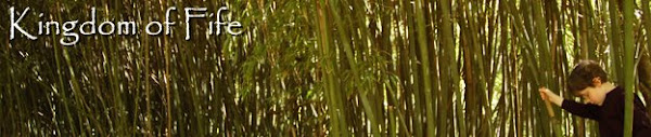
Above,
Brock's Monument (note Dudeboy and Dr. J for scale) at the
Battle of Queenston Heights (Oct 13, 1812). Queenston Heights was the first major battle of the War of 1812, and one of the first of the many bumbling disasters perpetrated by the US forces . . . which continued throughout much of the war. Still, you can't say it was the first, given the embarrassments at
Fort Michilimackinac (Fort Mackinac) and
Hull's surrender of Detroit. However, while the British repulsed this early concerted effort by the US to invade Canada, they did suffer the loss of the irreplaceable General Brock.
An odd little aside about the debacles at Fort Michilimackinac and Detroit centers around US Lieutenant Porter Hanks. He was the commander of Fort Michilimackinac who surrendered the fort without a fight. Forward to Detroit where he was waiting for the pending court martial . . . long story short, he was one of only seven Americans killed. A British cannonball cut him in half. Obviously, this was a man
not destined for greatness.
This is actually the second monument to Brock to be built on the battlefield . . . the first was bombed by terrorists! It is actually a pretty interesting story that centers around a man named
Benjamin Lett. Lett had little love for British rule and its Tory militia. He stirred up a bit of trouble at the time of the
Upper Canada Rebellion with the murder of a British Loyalist who was involved in the
Caroline Affair (apparently there is no real evidence that he perpetrated the crime, but it did not matter for the Tories were convinced of his guilt). While he is mostly remembered for the bombing of the Brock Monument, Lett was also involved in a lot of other questionable actions before being poisoned in the US. While the focus of our trip was the War of 1812, we were continually encountering sites pertaining to incidents and rebellions we knew little or nothing about . . . like the Upper Canada Rebellion (1837),
Lower Canadian Rebellion (1837), and the
Fenian Raids (1866-1871). We will come back to some of this with our non-War of 1812 entries for the trip.
I suppose you might wonder why Lett's bombed a monument dedicated to the War of 1812. Well, as the Canadian Encyclopedia explains that "Although Brock was almost considered a saint by the Loyalists of Upper Canada, some viewed his monument as a symbol of the arrogant Tory militia and of British rule; it made an ideal target for vengeance."
Of course, we climbed the almost 190 feet and 235 steps to the top of the monument, and were treated to this view. The wind was really whipping up there. I must add, I did nothing to change the color in this photo.
In 1929 lightning struck Brock's statue atop the monument, severely damaging it and sending pieces to the ground. Fast forward to the 1960s: students from the nearby Brock University "found it" stored and decided that it needed to be liberated. The pieces
were then removed to a new location on the campus of the university. It was only recently that the Niagara Parks Commission reclaimed the arm, but apparently a portion of the torso still resides at the university.
Our personal tour guide who is appropriately named Brock! His family owned some of the battlefield at the time of Queenston Heights, so his name is tied to family as well as Canadian history. I must add that Brock was very pleased to lead a tour for people who had a genuine interest in the battle. It was a very hot day, and we told him he did not need to wear the uniform on our account. He dismissed that by stating that since we made the effort of traveling from Kentucky, he would go full uniform! In the photo above, Brock is relating the story of how the Americans scaled the cliffs that had been viewed as "unassailable." The inscription states:
An unguarded trail up this steep cliff was the only route which the Americans had to the heights of Queenston. The trail was to your right but does not exist any longer. Trapped on the river shore by unrelenting gunfire, the Americans contemplated a desperate action: the ascent of this cliff. The British, positioned on a ledge between here and the Village of Queenston did not detect the movement and the attackers took the Heights by surprise. However, later in the battle this cliff became a cruel barrier between the Americans and safety on the other shore.
"The loss of the redan battery and Brock's death" . . . inscription from the marker:
On the river banks below here, the Americans were trapped. To the right the Americans scaled the river cliff and seized the Heights above. To the left the British held the Village of Queenston. A British 18-pounder cannon situated here within an earthwork called a "redan". On October 13, 1812, this cannon hindered the reinforcement of the American troops trapped below. Arriving from Fort George, Major-General Brock came here to direct the defence of Queenston and await reinforcements, however the small enemy detachment which had scaled the cliffs behind the redan made a surprise attack forcing the British to retreat into the village. Brock led two hundred men in a counter-attack during which he was mortally wounded. Another assault, led by Brock's aide de camp, John Macdonell, was repulsed by the Americans who were soon firmly in control of the Heights.
Another marker not far from here reads in part:
While the Americans controlled Queenston Heights they were prevented from properly establishing their position by the harassment of 120 Indians under Chief Norton. In the meantime, Regular British troops and Canadian militia were arriving from Fort George and other outposts. Under the direction of Major General Roger Sheaffe, they climbed the heights of Queenston and assembled for the last battle.
Brock's Cenotaph . . . supposedly this monument marks the spot where Brock was killed, but the precise location in unknown. Moments before he was shot, Brock was said to exclaim "Take breath, boys. You will need it in a few moments." Nearby is a monument to Brock's horse
Alfred. Of course, there is some dispute whether Alfred was even at the battle, as Brock (like most commanders) had several horses.
"Sheaffe's Path to Victory" . . . this small monument marks the location where the British forces (First Nations, British Regulars, and Canadian Militia) scaled the escarpment for a surprise attack at the rear of the US forces. This maneuver forced the surrender of nearly 1000 US troops. Sheaffe's accolades were short lived for he was later severely criticized for his actions at the
Battle of York and subsequently recalled to Britain.
The remains of Fort Riall (above) and Fort Drummond (not pictured) which are located near Brock's Monument. These fortifications were built later in the war during the year 1814. British controlled them for about a month after completion. The Americans took control after the Battle of Chippawa . . . and promptly lost it back to the Brits in the aftermath of Lundy's Lane. This area was a key for the protection of the Lower Niagara River.
Dr. J and Dudeboy inhaling some
Laura Secord chocolate at the
Laura Secord Homestead. The marker states:
Born in Great Barrington, Massachusetts, Laura Ingersoll came to Upper Canada with her father in 1795, and settled in this area. About two years later she married James Secord, a United Empire Loyalist, and within seven years they had moved to this site from nearby St. David's. From here during the war of 1812, Laura Secord set out on an arduous 19-mile journey to warn the local British commander, Lieutenant James Fitzgibbon, of an impending American attack. The courage and tenacity displayed on this occasion in June 1813 places her in the forefront of the province's heroines. Mrs. Secord's house, a simple frame building, was restored (1971-72) and remains as a memorial to the exceptional act of patriotism.
We have encountered the story of Laura Secord in a couple of earlier entries . . .
here and
here. So, I am not going to elaborate much more other than to say we sure did enjoy "her" chocolate.
The
Burning of St. Davids (1814) . . .
On July 18th, 1814, during the final American campaign on the Niagara frontier, Major-General Peter B. Porter sent a detachment of militia from the United States encampment at Queenston to attack St. Davids. This force, commanded by Lieutenant-Colonel Isaac W. Stone, was joined later by a small group of American regulars. Despite opposition from the 1st Lincoln Militia, the enemy captured the village, looted it and burned most of the buildings. Stone was severely censured for this destruction of private property and summarily dismissed from the United States army.
The Battle of Cook's Mills (October 19, 1814). This was the last engagement
of the war in the Niagara Peninsula. From the Historic Places of Canada website:
The Battle of Cook’s Mills was an important engagement for British and Canadian troops during the War of 1812. After his unsuccessful siege of Fort Erie, Lieutenant-General Gordon Drummond retreated west and concentrated his army around the Chippawa River. In October 1814, American forces under Major-General George Izard advanced west to assault Fort Niagara. Finding Drummond firmly entrenched along the Chippawa River, Izard sent a force of about 900 men to test the British right flank on Lyon’s Creek. On October 19, at Cook's Mills, a heavy skirmish took place, involving men of the Glengarry Light Infantry and the 82nd, 100th and 104th Regiments. Led by Lieutenant-Colonel Christopher Myers the British and Canadian troops forced the Americans to withdraw and retreat to Fort Erie.